Data Resource Library
Explore reports, interactive maps, and dashboards created by Data You Can Use.
- Start with our featured tools below – especially if you’re looking for neighborhood data
- Keep scrolling for more specific reports and interactive data tools
- Advanced user? Access raw datasets in the DYCU Hub.
- Questions? Contact us at [email protected].
Featured Data Tools
Neighborhood Portraits

Change Over Time Portraits

Neighborhood Dashboard
MKE Indicators
Interactive Maps and Dashboards
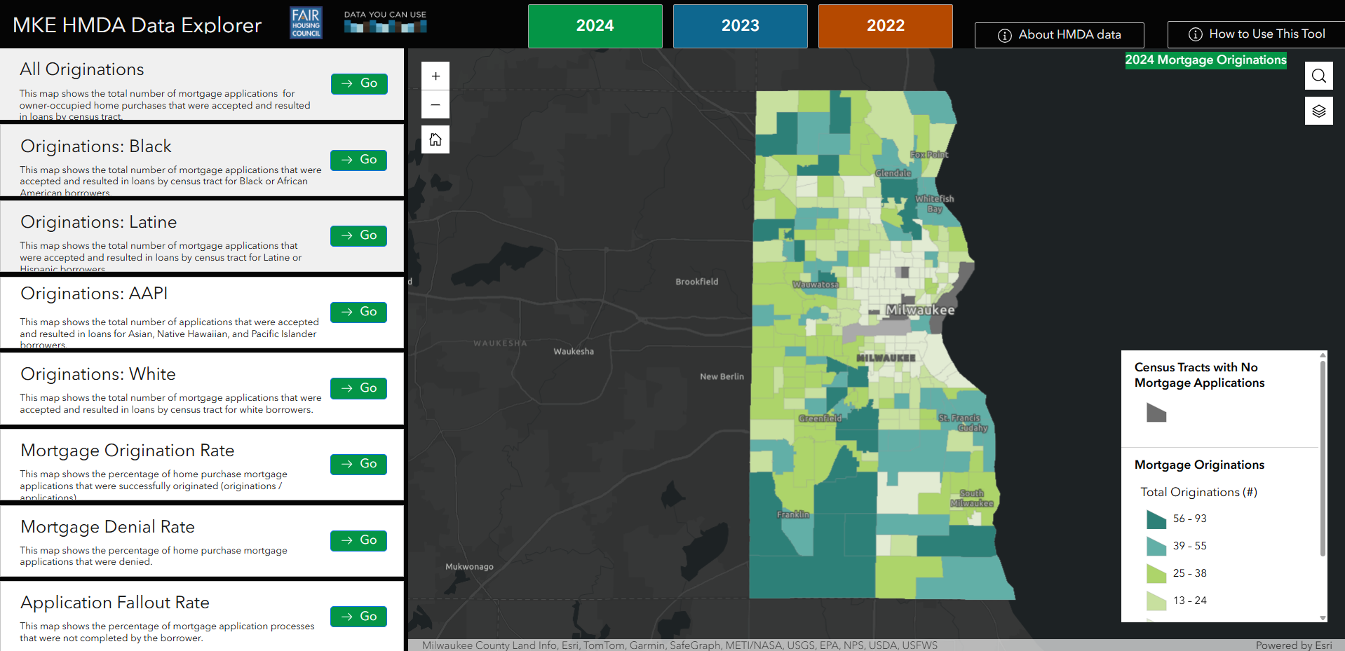
MKE HMDA Data Explorer
Home Mortgage Disclosure Act (HMDA) data allows curious data explorers to understand how many people applied for mortgages, and the actions taken on those mortgage applications (i.e. if they were approved, denied, or never completed). In the MKE HMDA Data Explorer, HMDA data is shown by census tract for Milwaukee County to better understand the distribution of mortgage investment across Milwaukee Neighborhoods.
This map originated through a collaboration between the Metropolitan Milwaukee Fair Housing Council and Data You Can Use.
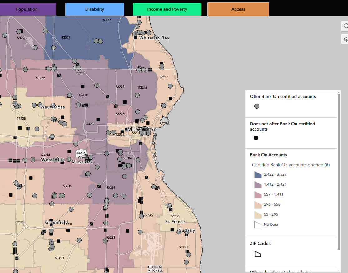
Bank On Greater Milwaukee Financial Inclusion Map
This mapping portal is a tool for Milwaukee residents, service providers, financial institutions and others who believe that access to bank accounts is paramount for financial health and stability. Bank On Greater Milwaukee is committed to financial inclusion, partnering with local financial institutions to offer no or low-fee checking and savings accounts to customers who may face barriers to traditional banking. These maps show where financial institutions are located and which of these have with Bank On certified accounts.
Learn more about Bank On Greater Milwaukee here.
Learn more about Bank On National Account Standards here.
These interactive maps were created by Data You Can Use in partnership with Bank On Greater Milwaukee and the Urban Economic Development Association, with funding support from the City of Milwaukee grant of Community Development Block Grant funds.
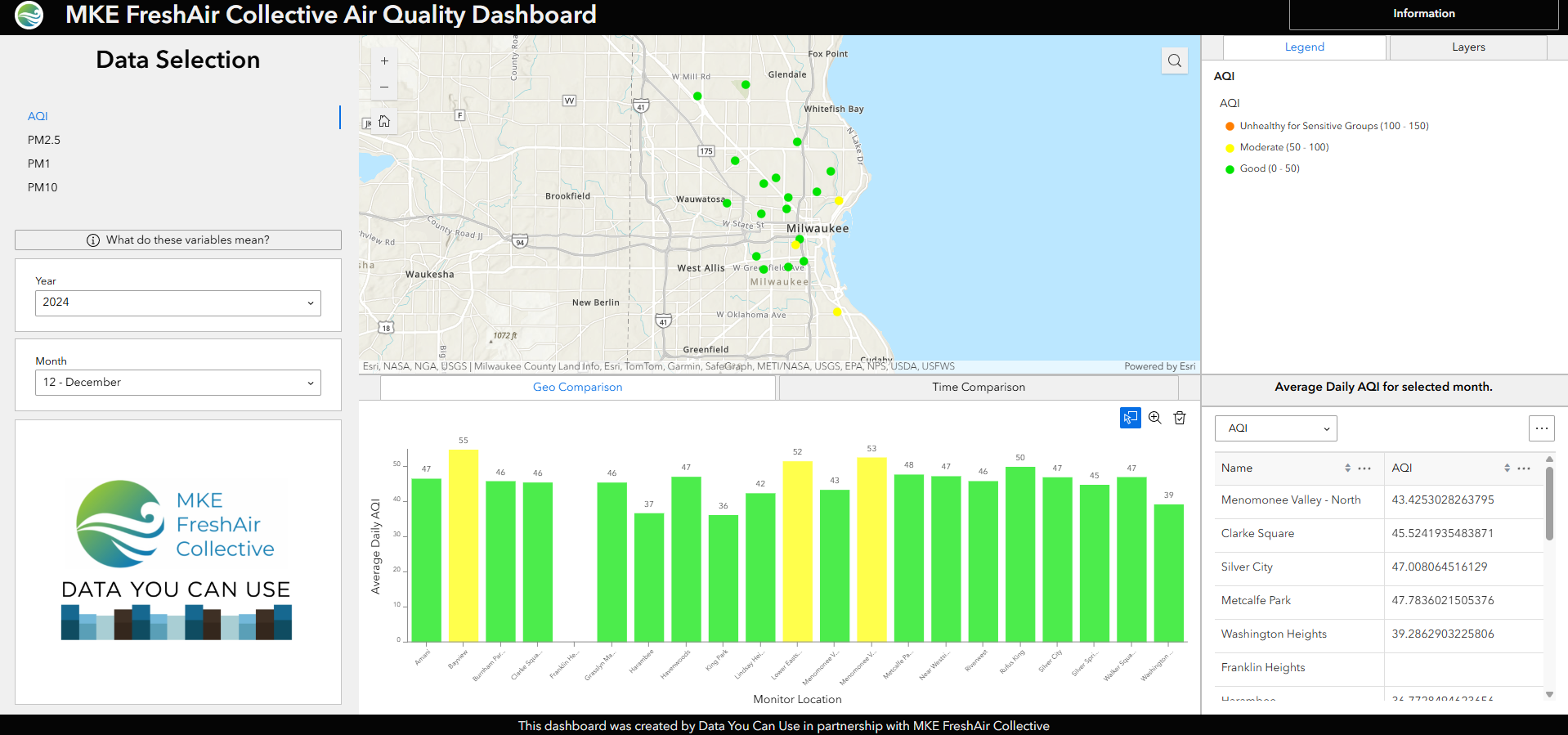
Milwaukee Air Quality Dashboard
MKE FreshAir Collective was established in December of 2019. Since its inception, the Collective has deployed over 20 outdoor air quality sensors around Milwaukee to track air-quality in real time. This dashboard, created by Data You Can Use, displays the data collected by the sensors in 2023 and 2024, to be used by Milwaukee residents to better understand the air quality in their neighborhoods.
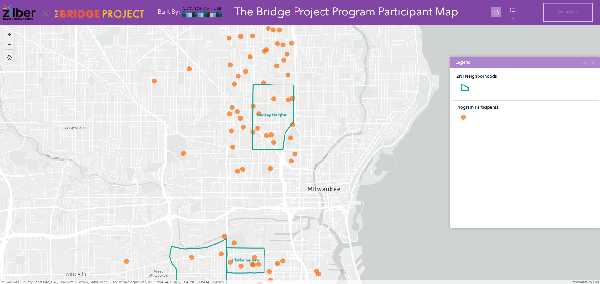
The Bridge Project Participant Map
Data You Can Use serves as a data partner to the Zilber Family Foundation. In an innovative collaboration, the Zilber Family Foundation joined forces with The Bridge Project to introduce Milwaukee first unconditional cash program. This transformative program was dedicated to empowering the community through financial assistance, focusing on providing unconditional cash transfers to pregnant individuals in the city. Data You Can Use created this participant map to track the project’s progress.
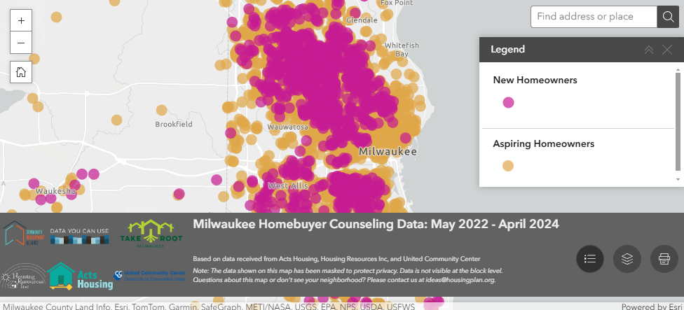
Milwaukee Homebuyer Counseling Data
Data You Can Use serves as a data partner to the Community Development Alliance (CDA). Through that partnership, we have worked with the CDA’s partner homebuyer counseling agencies to track progress in advancing homeownership in Milwaukee. This map serves to show all individuals who have entered homebuyer counseling through the partner agencies and the subset of those individuals who have purchased a home. The locations of these individuals are masked to protect their identities, with the locations being randomized within a certain radius of the true location, and the dots not being visible as a user zooms in to a certain level on the map. With this map, one can toggle boundaries, including State Assembly Districts, State Senate Districts, County Supervisory Districts, City Aldermanic Districts, and various neighborhood boundaries. For each boundary, a user can click on a district/neighborhood and see the counts of aspiring and new homeowners within the boundary.
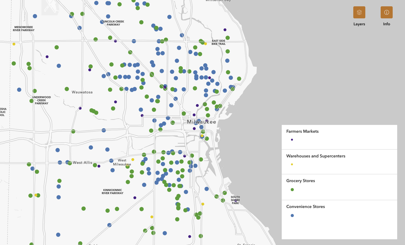
Milwaukee Food Environment Map
At Data Day 2023, the Milwaukee Food Council was awarded a Data Dream. Through the collaboration between Data You Can Use and the Milwaukee Food Council, the Milwaukee Food Environment Map was created to aid service providers and community members in identifying where food can be accessed in Milwaukee County.
This tool has two geographic maps and one network map. The first map displays the Emergency Food environment of Milwaukee County, including the food banks, pantries, and meal sites where individuals can seek food assistance. The second map displays the Food Access environment of Milwaukee County, including most establishments where food can be purchases, such as grocery stores, farmers markets, convenience stores, and warehouses / supercenters. The Food Network Kumu Map shows the relationship and connections between the various food actors of Milwaukee County.
This tool is brought to you through a collaboration between the Milwaukee Food Council, the UWM Institute for Systems Change and Peacebuilding, and Data You Can Use.
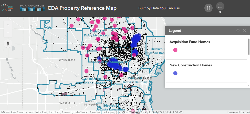
Milwaukee Property Reference Map
Data You Can Use serves as a data partner to the Community Development Alliance (CDA). Through that partnership, we developed a property reference map to aid service providers, advocates, policymakers, and residents to understand the landscapes of their neighborhoods. This map shows the vacant lots, property sales, acquisition fund, and new construction homes built in the City of Milwaukee. Selectable boundaries include City Aldermanic Districts and various neighborhood boundaries, and selectable layers include 2020-2023 property sales, total vacant lots, City-owned vacant lots, privately-owned vacant lots, and zoning codes. Also displayed are the homes purchased through the acquisition fund and are new construction homes. The locations of these homes are masked to protect identity, with the locations being randomized within a certain radius of the true location, and the dots not being visible as a user zooms in to a certain level on the map. The user can click on each parcel to see the associated MPROP information or property sale information, and can click on each boundary to see the summary of property sales, vacant lots, acquisition fund homes, and new construction homes.
Reports
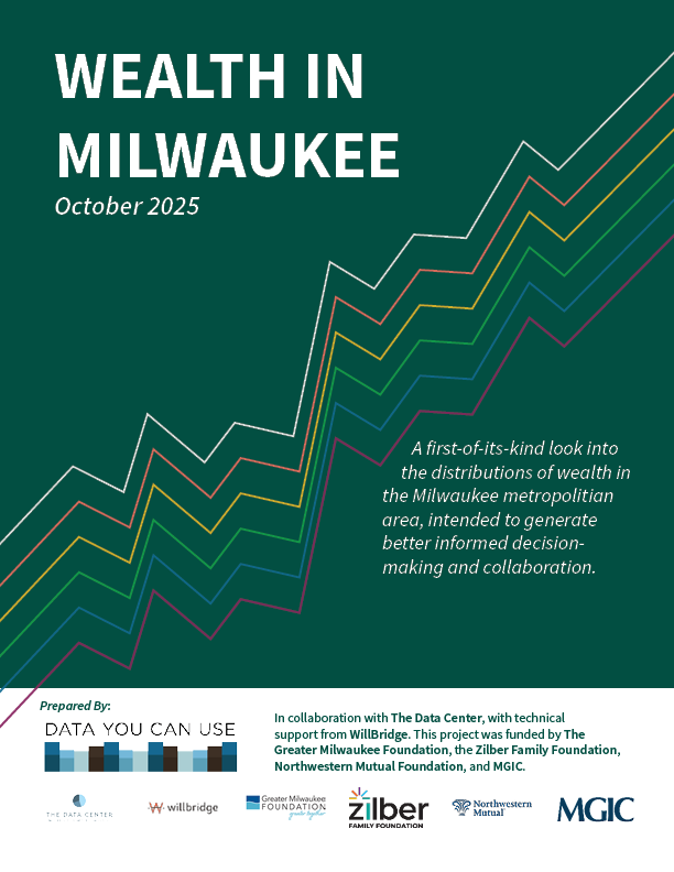
Wealth in Milwaukee
This report debuts a first-of-its-kind look at the distribution of wealth in the Milwaukee metro area. Previously only available at a national level, local wealth estimates will play a key role in idenitifying specific wealth gaps and areas of need, all for the end goal of prosperity for all Milwaukeeans. Data You Can Use prepared this report in collaboration with The Data Center, with technical support from WillBridge. This project was funded by The Greater Milwaukee Foundation, the Zilber Family Foundation, Northwestern Mutual Foundation, and MGIC.
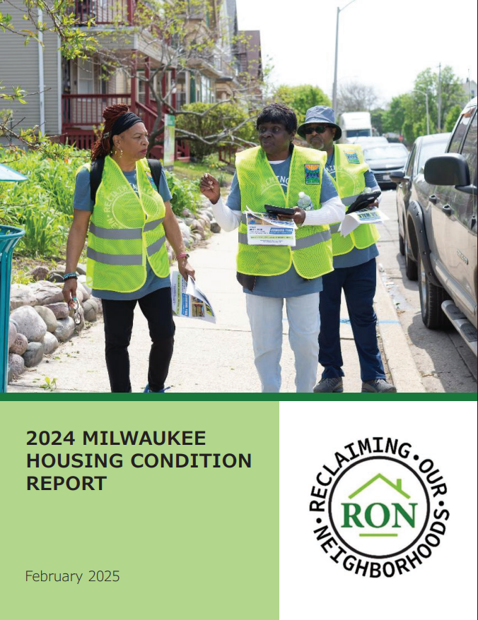
Milwaukee Housing Condition Report
Reclaiming Our Neighborhoods (RON) is a highly effective coalition of 11 neighborhood partner organizations representing 15 neighborhoods, working alongside City of Milwaukee partners and housing agencies with the mission to improve the quality of housing in Milwaukee through data-informed, resident-engaged strategies and actions. Data You Can Use proudly serves as RON’s data partner for the housing surveys.
The data presented in these reports represents a summary of exterior housing condition data collected by neighborhood partners. Neighborhoods using housing surveys are better able to connect available technical assistance and financial support with those who need it most.

Amani Safety Initiative
The purpose of the Amani Safety Initiative, which was supported through a Byrne Criminal Justice Innovation grant from 2016 – 2020, was to engage residents and use data and best practices to improve police and community relations while increasing safety in the Amani neighborhood. Partners included Milwaukee Police Department, Dominican Center, Safe & Sound, LISC Milwaukee, Amani United, COA, Hepatha Lutheran Church, the District Attorney’s Office, and Data You Can Use.
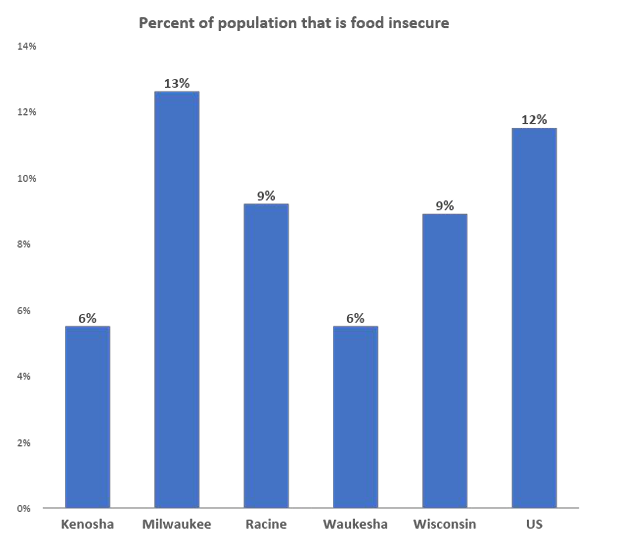
Indicators of Poverty
This report, compiled in November 2020, is intended to provide a basic overview of population demographics and other indicators relating to poverty in the Siebert Lutheran Foundation service area. These indicators were selected for their relevance to the foundation’s expressed interest around poverty in the four counties of Kenosha, Milwaukee, Racine, Waukesha. Data at the national and state level have been provided for comparison.
Milwaukee Air Quality Report
In 2024, Data You Can Use partnered with the MKE FreshAir Collective to analyze and visualize the data they collected through their air quality sensors. The mission of MKE FreshAir Collective is to provide accurate, timely information about air quality in Milwaukee to residents, businesses, and policymakers, with a steadfast commitment to equity and addressing systemic racism. They use state-of-the-art, consumer accessible equipment to monitor air quality in real-time. Our 2024 report analyzes trends in air quality at a neighborhood level, utilizing the data from MKE FreshAir Collective’s air quality sensors.
FoodCare Coalition Evaluation Report
The FoodCare Coalition is a collective of community-based and healthcare organizations, convened by the Children’s Health Alliance of Wisconsin, who seek to build capacity for food systems and health systems to partner. The initiative intends to strengthen community across food banks, food pantries and primary care clinics to increase food security and health of children and youth.
Data You Can Use serves at the data partner of the FoodCare Coalition, aiding evaluate the coalition’s progress in building relationships between food and healthcare sectors. In 2024, we published an Evaluation Report of the Coalition’s partnership.
Who's Coming Home?
Project RETURN was a winner of the 2020 Data Dream Award from Data You Can Use (DYCU) with sponsorship from the Siebert Lutheran Foundation. Project RETURN (Returning Ex-incarcerated people To Urban Realities and Neighborhoods) exists to help men and women make a positive, permanent return to community, family, and friends. Project RETURN leadership wanted to know more about the characteristics of those who would be returning to Milwaukee County so that they could better prepare and advocate for adequate resources for the recently incarcerated. Their experience led them to identify housing as a primary need and studies show that stable housing is related to reduced recidivism.
Black & Latine Youth Achievement
This project examines the intersection of quantitative data with life experience as it affects Black and Latine youth in Milwaukee. Data was collected from the U.S. Census and the Wisconsin Department of Public Instruction and shared with partners through small, focused conversations called “data chats”. Data chats provide an opportunity for those most affected and closest to the data to discuss how the data reflects their unique experiences and to consider possible solutions for issues. Check out the full reports to see what themes around Black and Latine Youth Achievement in Milwaukee were uncovered over the course of two data chat projects.
Food Access in Milwaukee
In Fall 2024, Data You Can Use (DYCU) convened three data chats with Milwaukee residents to discuss food access and health. Using the model of small, focused conversations called “data chats”, DYCU partnered with community organizations to learn from Milwaukee families about the state of food access in the city. Understanding the experiences of Milwaukee families working to provide healthy food and quality health care for their children will help guide the FoodCare Coalition in their efforts to create thriving conditions for these families.
The FoodCare Coalition is a collective of community-based and healthcare organizations, convened by the Children’s Health Alliance of Wisconsin.
Turning the Corner
Launched in January 2016, this project pilots a research model that monitors neighborhood change, drives informed government action, and supports displacement prevention and inclusive revitalization. Local teams in Buffalo, Detroit, Milwaukee, Phoenix, and Twin Cities conducted independent research to understand neighborhood change and displacement risk in their communities. The Urban Institute, funded by the Kresge Foundation, synthesized lessons across the five cities. For more information, see the cross-site study here.
This study is part of a larger national effort titled Turning the Corner: Monitoring Neighborhood Change for Action, a project guided by the Urban Institute’s National Neighborhood Indicators Partnership and the Funders’ Network Federal Reserve-Philanthropy Initiative.